February 1, 2012

Geographic Concentration of Terrorist Attacks in the U.S., 1970 – 2008 (Image: START)


Geographic Concentration of Terrorist Attacks in the U.S., 1970 – 2008 (Image: START)
Researchers, as part of the National Consortium for the Study of Terrorism and Responses to Terrorism (START) under the Department of Homeland Security, are trying to come up with a way to better predict where and when terrorist attacks would happen on U.S. soil.
To start, the researchers from the University of Maryland and University of Massachusetts-Boston mapped all events considered terrorism since 1970 to 2008 in the United States (below). This established areas they deemed terrorism “hot spots” but also revealed that terrorism is actually “widely dispersed”. So widely dispersed that every state has experienced some act of terrorism in some form, according to the report. The report defines a hot spot as an area where more than the average number of terrorist attacks have taken place — the average for the U.S. is six.
NOTE:
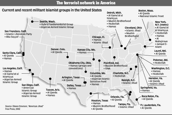
While the Obama administration continues a policy of removing the "idea" of Islamic threats to Americans, by simply having the identity of Islamic terrorism removed from federal documents, Americans Stand with Israel has posted numerous maps of Islamic training camps in America. We have also asked how this is possible, why has it been allowed, when the United States of America has been fighting a war against Islamic terrorism for over 10 years. The expression "the enemy within" and "home-grown terrorism" is a reality and yet, the camps are allowed to pop up every where in the United States without anyone in Washington, DC taking this seriously enough to investigate and SHUT THEM DOWN!


